– Dr. Ron Martino, Dept. of Geology, Marshall University
Anyone who has grown up in WV or has at least spent some time outdoors here knows that there are many parts of the state that are truly wild and wonderful. Our wildlife ranges from bears, coyotes, mountain lions, bobcats, turkey, and elk to rattle snakes, copperheads, salamanders, lizards, crayfish, millipedes, to mention a few. These critters are well adapted to the temperate, moist climate that the Mountain State currently enjoys because of its midlatitude (~ 35o-40o N Latitude) location.
When was Then?
However, it wasn’t always so…. The sedimentary rocks that make up the bedrock of West Virginia were deposited mainly as sand and mud during the Paleozoic Era, a division of geologic time based on the presence of the remains of primitive life forms, most of which are now extinct. We would have no knowledge of these prehistoric creatures were it not for the remains and traces left by them in the sedimentary rock layers. The rock layers that crop out along the highways around Huntington are from the Late Pennsylvanian Period of the Paleozoic Era, which most geologists suspect formed about 300 million years ago.

Fig. 1. Geologic Time Scale. Units of time are in millions of years and are based on radiometric dating and assumptions about rates of decay. https://geologyscience.com/
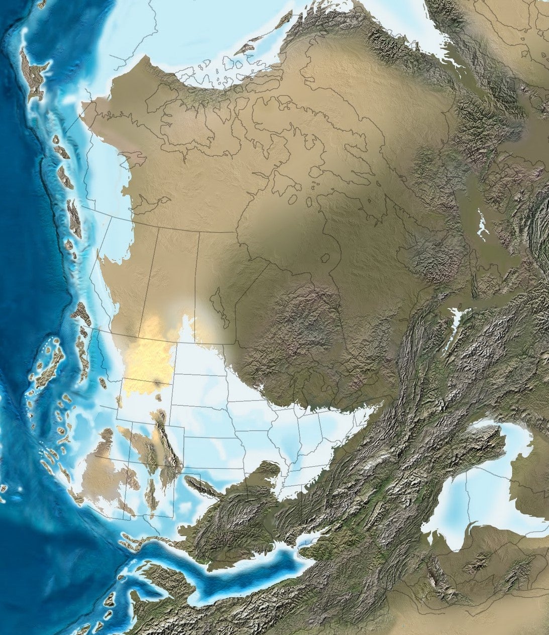
During the Pennsylvanian Period, WV really was a mountain state with the Appalachians rising as high as Himalayan Mountains do today. Regional uplift along with bending and breaking of rocks from Alabama to New England resulted from the collision of the African part of the supercontinent Gondwana, with the Atlantic margin of North America. Most of the central and western portions of WV consisted of a tropical coastal lowland that bordered a shallow sea covering much of the interior of North America. Geologists can interpret the kinds of environments existed in the past by comparing sandstones and shales, with sand and mud sediments exists in modern-day environments.

Fig. 2. A Pennsylvanian paleogeographic reconstruction of the Gondwanan-Laurussian super-continental collision showing the uplifted Appalachian Mountain chain. Red box shows location of the WV-OH-KY tristate area. Late Pennsylvanian terrestrial animals included reptiles, amphibians, and insects. Dinosaurs did not appear until the Triassic Period, about 75 million years later. From Ancient Landscapes of Western North America by Blakey and Ranney, 2018.
Flood plains and track preservation
When rivers like the Ohio flood, they spread broad sheets of mud across the floodplain. As the floodwaters recede, the mud (which is 80% water) is exposed and begins to dry out. There is a critical time, before it completely hardens and cracks, when animals moving across the mudflats can leave very detailed trackways that are then preserved as the mud hardens and as more sediment from the next flood fills in the footprints producing casts.
Fig. 3. River floodplain with recent lobate deposit of moist mud, an ideal medium for preserving trackways. https://www.geol.umd.edu/~jmerck/geol342/lectures/10.html.

Fig. 4. Tracks from an otter in recent sand and mud. Moist floodplain sediment makes an excellent medium for preserving footprints. https://www.shetlandnature.net/otters/otter.
Pennsylvanian Period Trackways of an Alligator-like Amphibian (Eryops)
In 1990, John Pauley and Bill Stewart reported they had found bear tracks in rocks from a dried- up creek bed on a farm in Wayne County southwest of the town of Wayne. As it turns out, the tracks had been made in an ancient floodplain by an alligator-like amphibian called Eryops avinoffi. Such complete trackways are very rare and when discovered enable geologists to reconstruct details about how and where these extinct creatures lived. A more recent study of skeletal remains at the Carnegie Museum in Pittsburgh has since reclassified Eryops avinoffi under a different slightly more primitive genus Glaukerpeton (Werneburg and Berman, 2012).

Fig. 5. Type specimen for Limnopus glenshawensis, the name for the trackway left by Eryops. Specimen is on display in the Science Building (2nd floor) at Marshall University (scale at left is 30 cm (~ 1 ft). The photo shows the bottom of a layer of sandstone with tracks preserved as natural casts.

Fig 6. Labeled drawing of trackway. The AB line indicates the distance from the base of the neck to the midpoint of the pelvic area. The total length of the amphibian from tip of snout to end of tail was about 1 meter (3.28 ft).

Fig 7. The front foot (manus) was shorter with 4 toes, whereas the back foot (pes) was longer with 5 toes. There were no claws as can be seen from the rounded impressions of the toe prints (from Martino, 1991, Limnopus trackways from the Conemaugh Group (Late Pennsylvanian) southern West Virginia: Journal of Paleontology, v. 65, no. 6, p. 957-972).
The rocks containing the abundant and well-preserved tetrapod footprints are part of the Glenshaw Formation (Lower Conemaugh Group). The tracks occur along at least three horizons within a 30-cm-thick interval. The tracks are preserved mainly as casts on the underside of thin-bedded, ripple cross-laminated sandstones and less commonly as molds in intervening dark-gray shales. Associated body fossils include Spirorbis worm tubes and washed-in plant debris. The tracks were likely to have formed along the margins of an ephemeral lake in a flood basin setting adjacent to deltaic or river channels. Most of the tracks can be assigned to the ichnogenus Limnopus, making them one of the earliest known occurrences. At least five trackways are discernible with an external width ranging from 32 to 40 cm.

Fig. 8. Illustration of the origin of footprints preserved as raised surfaces (natural casts) on the underside of a sandstone layer. When sand (yellow) and mud(red) are buried, they become sandstone and shale. Eventually weathering and erosion expose the layers of rock. As weathering continues, the shale disintegrates, but resistant sandstone does not.

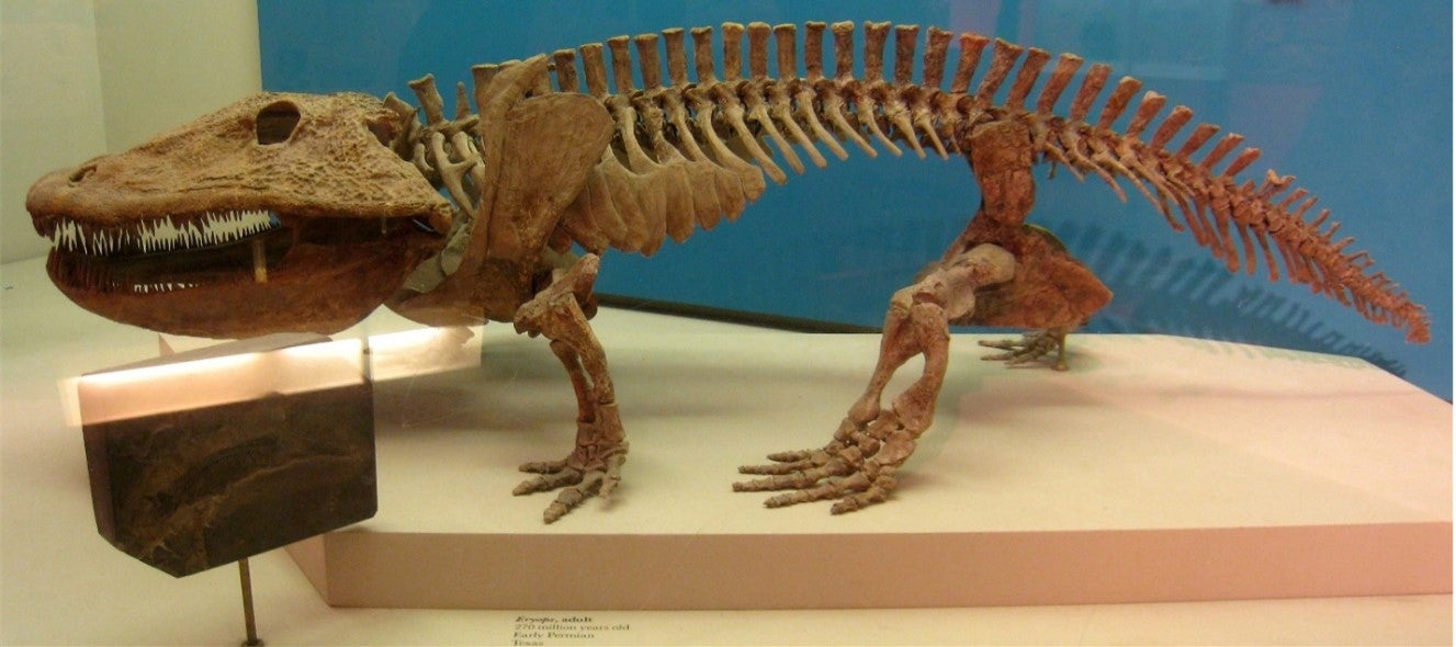
Fig. 9. Skeleton of Eryops (now reclassified as Glaukerpeton) , about 2 m in length. It was such this type of toothed amphibian that made the Wayne County trackway. Daderot – https://commons.wikimedia.org/w/index.php?curid=8710123. Erypos became extinct by the Middle of the Permian Period due to increasing aridity and accompanying reduction in wetlands which these amphibians needed in order to reproduce.

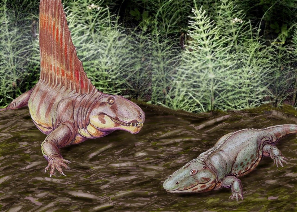
Fig. 10. Reconstruction of Eryops (on the right) with sail-finned reptile Dimetredon, one of its few natural enemies. Dmitry Bogdanov, https://commons.wikimedia.org/w/index.php?curid=3919804
Closing thoughts…
Geologists are able to interpret what the Earth may have looked like in the past and what types of organisms may have populated its surface. The Earth is constantly changing, although some processes like continental drift are too slow to be readily perceptible day-to-day. If we take the record of ancient life now preserved as fossils at face value, there have been 5 periods when most of Earth’s creatures were wiped out by mass extinctions. The greatest of these mass extinctions occurred at the end of the Paleozoic Era. The leading hypothesis for what caused the mass extinction event involves t a period of unusually intense volcanic eruptions. These eruptions produced massive emissions of gases which changed the chemistry of the atmosphere and oceans, as well as the climate. Events in earth history tend to recur from what we can tell, and understanding what caused past extinctions and climate change may help mankind anticipate and survive the next biotic crisis.
